The RAF in Suffolk

Members Login
Username 
 
Password 
    Remember Me  
Post Info
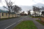
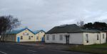
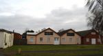
TOPIC: A Virtual Tour of MH


Administrator

Status: Offline
Posts: 6693
Date:
A Virtual Tour of MH


I will be adding a circular tour of Martlesham Heath starting and finishing at The Control Tower Museum. I wish to have this thread closed so that the walk is a continuous one, so a read only thread for the time being.

This might take a little while to complete as I wish to get things exact re co-ordinates on OS Maps and pictures in the right place, so please bear with me.

We are now coming to the time of the year [Autumn/Fall] where part of this walk is stunning, I have been fortunate enough to walk the New Forest, The Forest of Dean, Epping Forest and a few others but one part of MH woods is [IMO] equal to these mentioned.

Part of this walk is covered by the Route 66 Ipswich to BT Martlesham Bus route, part of the route is accessible by wheelchair or motorised mobility scooter but I'm not in a position to say whether the whole route is accessible thus.

By doing this, those who live far away can 'visit MH by virtual reality', those that live nearer come and see what you have been missing!  

__________________


Administrator

Status: Offline
Posts: 6693
Date:

To get to The MHAS Tower

By bus from Ipswich Rail Station through Ipswich Town Centre, East Ipswich past the hospital, through Kesgrave and take stops well after Tesco's Extra and the British Telecom stops, get off at Eagle Way.

The Museum is only open on Sundays see here http://www.mhas.org.uk/museum/index.html

By car/By road:

Turn off the roundabout on A12, exit opposite BP Garage/Tesco Extra into Eagle Way then 3rd right into Parkers Place.

I use Ordnance Survey Landranger Maps and the location of the Tower is TM243452 or

52°03′28.79″N 001°15′57.6″E

Behind the Control Tower to the West can be found an underground bunker only open when the Control Tower Museum is open

From the Control Tower Car Park face North and take the hard standing route from this photograph, which will take you through a splendid wooded area managed by Portal Woodlands Conservation Group   http://www.martlesham.org.uk/index.php?module=article&view=29&MMN_position=65:65


You can keep to the old Peri Track or bear left onto a path that has a thick layer of woodchippings/bark applied this is very comfortable to walk on, both walks are very enjoyable and level, if you wish to take advantage of seeing the revetments you will need to take the left fork by the very large Conifer Tree and follow the path round until you come back on to the Peri Track which meets opposite the gates to Suffolk Police Force HQ Playing Fields

__________________


Administrator

Status: Offline
Posts: 6693
Date:

At Tesco Extra there is a cafe and toilet facilities, it was here that one huge hangar was demolished to make way for this superstore at the time I felt this was sacrilege, I still do, as this area must have been one of the most famous British Aviation Sites existing, but big conglomerate companies have the power and the money to move mountains

Continuing the second phase of the walk, you could park in Beardmore Carpark, there are a couple of routes here one is to travel in an Easterly direction which will bring you to the old Airmens Married Quarters [AMQs] keeping the Caravan Sales depot on your right and then continue on the pavement via AMQs there are some old buildings scattered around this area but I do not know what they were used for but you can continue round past the static homes park and taking a cut through to Betts Avenue and back to the carpark or a better bet is to go from Beardmore carpark, turn East then immediately south on foot.

This brings you directly on to the old Woodbridge to Felixstowe Road........

...........to be continued as I have some new photos of this area from yesterday.........

__________________


Administrator

Status: Offline
Posts: 6693
Date:

Stage 3 of the walk From Beardmore carpark at Martlesham go out on to the Woodbridge/FXT road opposite the entrance to Marquis the Motorhome Dealers and turn right, follow this road to where the BT Tower can be seen close up, Barrack Square is opposite. From Beardmore Park the first thing you will encounter is a GVIR Pillar Box, that must have been in place prior to 1952/3  On your left are a series of linked buildings what these are I have no idea, I did think previously this might have been for the Parachute Packers.

MH Old Felixstowe to Woodbridge Road 2007 022.JPG

 MH unknown 016.JPGMH Unknown 017.JPG


Attachments
__________________


Administrator

Status: Offline
Posts: 6693
Date:

From the Douglas Bader Pub it is difficult to explain how to get to the runway except to say that the runway is in the approximate area of TM257454 and you would need to go South from the pub for approx 1/2 a mile through either the housing development or via the Heathland.

The runway area and Peri Track is on private land and is normally fenced [barbed wired] off, there are stretches of Peri Track running all the way back to the Control Tower, nearly a mile in distance. This runs alongside Dobbs Lane which is the Parish boundary between Martlesham and Kesgrave

The total distance covered if walking the whole route is approx three miles

Pictures generally are

The Southern extremity of what is left of the N/S runway


Some of the Heath that covers part of the Peri Track


The Peri Track leading away from the extreme end of the runway facing North


I'm not sure what this means [DANGER in Russian at a guess, this is a fairly recent notice]


More undergrowth on the Peri Track, this whole area looks very colourful from April through to August [as shown]


Another view of the runway looking North


August and September you will see patches of Heather as here some growing on the Peri Track


Ditto, some of these pics are taken at different times of the year


A huge swathe of gorseland was burnt a few months ago this section between Peri Track and Runway [BT Tower in the background]


Once returned to the MHAS Control Tower please refer to this thread which describes adequately the Control Tower and immediate surrounding area

http://rafmartlesham.activeboard.com/index.spark?aBID=133322&p=3&topicID=30948470

Please feel free to correct or add anything you wish, I am only human!aww

__________________
1 2 36  >  Last»  | Page of 6  sorted by
Quick Reply

Please log in to post quick replies.


Create your own FREE Forum
Report Abuse
Powered by ActiveBoard